Our History
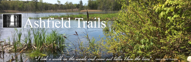
Ashfield Trails is a volunteer collaborative which for several years has been working to establish a community network of trails and footpaths in and around the Town of Ashfield.
After the first Gulf War started in 1990, Ashfield Trees were planted along Main street. Doug Cranson, a member of the Trees Committee, suggested the planters leave room for sidewalks to encourage walking. Susan Todd was impressed with how well the community responded to the Main street tree project and talked to Doug about trails. Susan had read that a good way to learn about a town and its history was to find and walk the old roads, long abandoned and discontinued.
When the second Gulf War began in 2003, Susan and Doug decided it was time to get started on Ashfield Trails. So it began, this vision to foster and encourage the development of a system of pedestrian trails linking remote sections of the town to one another, and eventually, it was hoped, to other towns.
Local Atty Richard Evans faxed a copy of MGL Ch 21 s 17c, the "Landowner Liability Statute" which protects landowners from liability arising out of recreational use of land by the public for no charge. Evans helped the committee craft language for a simple, non-binding agreement with landowners. To date, this has served the committee and landowners well.
The first meeting of the Trails Committee was held September 18, 2003. Susan Todd, Doug Cranson, Tom McCrumm, Lester Garvin and Mark Zenick met and approved a 5 year agreement with Franklin Land Trust as the official non-profit administrator. Trustees were: Carol Zambito, Richard Gougeon, Tom McCrumm, Norm Walker and Stewart Walker. In December, the committee met to strategize and assign tasks.
In January 2004, an article in the West County News headlined, "New Hiking Trail System Planned in Ashfield." The article went on to explain that Ashfield Trails in conjunction with The Franklin Land Trust (FLT) and The Trustees of Reservations (TToR) were working to tie together existing snowmobile trails and woods roads with sections of private land that leads into an off-road trail network that spans the town of Ashfield. It's a local citizen initiative from a group of people who've been meeting regularly. The first proposed trail was a 4 mile section connecting Sanderson Academy to the Lookout at Bear Swamp Reservation via Peter Hill.
The Committee met monthly to discuss potential routes, landowners and schedule trail work days.
The Ashfield Trails Steering Committee was Doug Cranson, Lester Garvin, Ned James, Tom McCrumm, Ellie Lazarus, Bob & Kit Nylen, Susan Todd and Carol Zambito. Mark Zenick from FLT and Steve McMahon from TTOR.
On March 23, 2004, Ashfield Trails was awarded a $1377 grant from The Trustees of Reservations Highlands Communities Initiatives Small Grant Program.
An inaugural guided hike was planned for May 2, 2004, the day after town meeting. About 40 people met at 1pm at Bug Hill road for a 2.5 mile hike to The Lookout.
In September and October, the committee discussed and explored a trail from Chapel Falls to DAR. They submitted a Recreational Trails Program Grant for trail creation and interpretation and Climber's trail rehabilitation at Chapel Brook Reservation.
In November, signage was discussed for points of interest like Peter Hill.
In 2005 the Committee met monthly to discuss signage, equipment and landowner consents.
New trail head signs designed by Jack Werner were installed starting in 2006. These signs have become an informal memorial to Jack who passed away shortly after he created the graphic art.
The Bear Swamp to Bug Hill Rd trail was opened and marked with arrows. Work began on the Chapel Brook to DAR trail; the trail was completed to West road. The Committee offered to purchase a chain saw for the town from grant money received, but the Town declined for liability reasons. Phil Pless joined the committee in July.
In 2007, the final link was completed connecting Sanderson to Bug Hill road. The Committee led a hike for the Williamsburg Woodlands Trail Committee from Chapel Brook to West road.
The laying out and opening up of the West Road to DAR Trail continued. Lester Garvin designed trail maps. Many volunteers joined the effort to see this new project get started and helped cut, clear and rake new trails. All helpers were treated to Susan's famous trail cookies.
The Committee was approached by Eagle Scout candidate Alex Geyster who wanted to build a bridge at Sanderson Academy west of the soccer field. The Committee helped with land and trail inventory for the Open Space Report for the Ashfield Planning Board.
Nineteen West County Champagne Hikers explored the trail from Sanderson to Bear Swamp late spring 2008. The 3.6 mile Chapel to DAR Trail was completed after numerous work sessions that included staff from The Trustees of Reservations and a youth conservation group from Holyoke. Trailhead signs and trail marker arrows were installed.
In several meetings, the Committee discussed bridges and decking for wet areas of the trails and whether to use pressure treated lumber or locally milled black locust. The Conservation Commission requested no pressure treated lumber on the trail north of 116 at the guard rail cut.
During the autumn of 2008, several volunteers worked on a trail from Chapel Brook Reservation to Lost Farm. Mark Zenick sent the first private donation of $50 from Shropshire, England.
Early 2010, maps for both trails were finished, printed and placed in Trail Map mailboxes at the trail heads.
The Massachusetts Recreational Trails Advisory Board, The Department of Conservation and Recreation, The Trustees of Reservation's Highlands Communities Initiative and Ashfield Trails organized and hosted a trails training workshop in May, 2010 at Sanderson Academy. This one day event was attended by over 70 people. A multi-user panel discussion, lectures and hands on workshops enlightened all who came.
Summer 2010, the Committee and volunteers worked on the Overlook to Northwest Cemetery Trail. Many workdays were planned through the fall. Meetings with landowners and abuttors to review proposed new trails occurred. The Trails Committee wrote our DC legislators about reinstating federal funding for the Federal Recreational Trails Program.
An Ashfield Trails Fan Page on Facebook was created and attracted 250 fans quickly. The first bridge on the West Rd to DAR Trail was moved upstream after it had washed out and was frozen in over the winter.
The Committee received a grant from the Pioneer Valley chapter of the New England Mountain Bike Association to build 400' of decking/boardwalk for the West Road to DAR Trail. This was completed in November.
The Committee laid out and flagged trails at the Bullitt Reservation and built Pebble Trail. Almost 200 people attended the grand opening at Bullitt, many hiked the new trail. It was decided to participate at fall festival with a booth that displayed trail maps and photos with a fundraising jar. Weed whacking, brush cutting and limb clearing were necessary ongoing trail maintenance chores.
Grant proposals were written and funding secured for several projects. These grants were used to buy tools, lumber for bridges and boardwalks, trail head and informational signs, directional arrows and trail maps.
New trails were proposed and built from Bear Swamp to The Overlook to the Northwest Cemetery to Smith Rd and up to Stroheker Rd., about 3 miles in length. Another trail, now named Two Bridges Trail, was built from the Bullitt Reservation to Chapel Falls, about 2 miles long.
Thus, a total of 20 miles of new trail were constructed in the first 20 years. Future projects include DAR to Sanderson Academy and Beldingville Road to the Bullitt Reservation over Mt. Owen.
Updated on:
- Website created by
Hilltown Techie
413-628-3959
© 2001- Ashfield Trails, Inc